Without question, one of the most spectacular and unique must-see’s of Ireland is the Wild Atlantic Way. From soaring cliffs, castle ruins, and ancient stones to some of the friendliest local villages of the truest, authentic Irish culture, the Wild Atlantic Way is a definite must to work into your destination wedding in Ireland. My recent trip to Ireland had me itching to explore a bit more of the island, especially the northwest which has eluded me for quite some time. It was finally time to make my way into the heart of the wild north — home of Mt Errigal, a picturesque countryside called Poisoned Glen that seemed straight out of a fairytale, and towering cliffs to rival the Cliffs of Moher.
This summer we’ll explore in detail some of the lesser known parts of Ireland, including the north. Cliffs and stone circles, pints and chowder, we’ll give you an exclusive look into the heart of Ireland and get you started on planning your dream destination wedding. First up is exploring the incredible Slieve League in Donegal. And don’t forget to check out the slideshow at the end!
A Trail of Irish Discovery
The Wild Atlantic Way is a trail spanning through nine counties of the Republic, following the coastline from south to northwest. The counties include: Kerry to the southwest, Clare, Mayo and finally Donegal to the northwest. It’s basically a coastline route to tour the western side of the island boasting over 1000 tourist attractions and discovery spots, unprecedented natural beauty and vista points, and an incredible look into Ireland’s history and culture. You can do the entire route in a few days, but if you don’t have the time you can certainly pick one section to work into your trip. You can think of these as “mini-loops” within the greater Wild Atlantic Way route.
The official route begins in the south at the charming historical seaport town of Kinsale. The trail will then take you through the heart of the Kerry coastline int he southwest, guiding you to the far-most points on the peninsula before making your way into Clare, home of the world famous Cliffs of Moher. Explore some of the most insanely gorgeous and breathtaking views and venture a bit into the historic ancient Burren — two places Waterlily Weddings has had the distinct pleasure of planning some of the most amazing weddings and elopements — before making your way farther north still. Hugging the western coast through Sligo and Donegal will give you some incredible payoffs in views and natural beauty — which will be the focus of this blog post today!
Soaring Higher Still
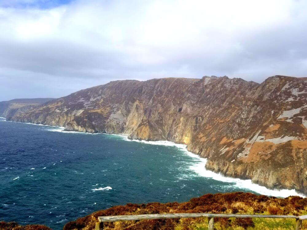
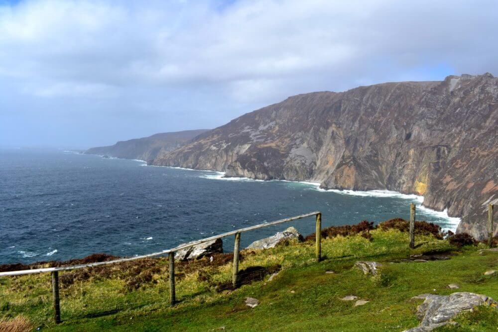
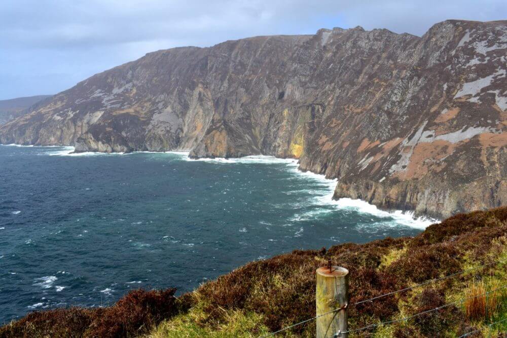
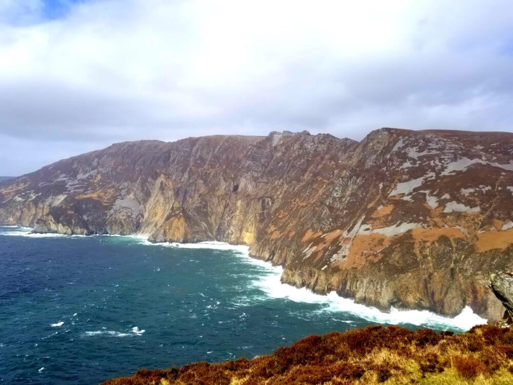
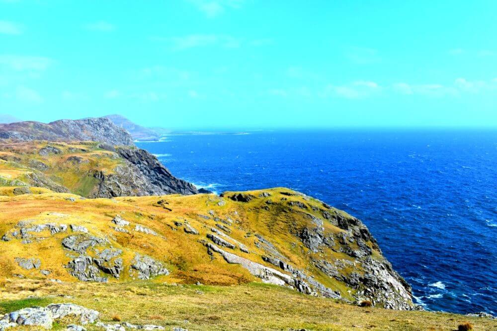
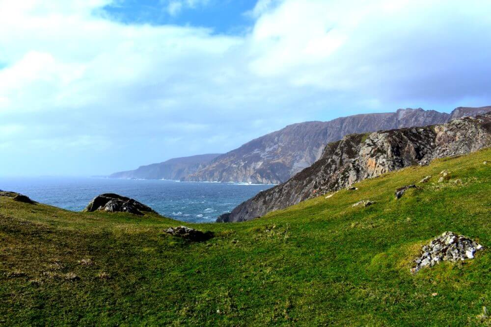
Sliabh Liage or Slieve League is a cliff-side mountain range on the Atlantic coast in County Donegal, boasting some of the most spectacular scenery and vista points in the entirety of Ireland. Although everyone knows the Cliffs of Moher, Slieve League is actually three times higher in elevation, and on a sunny day you can see all the way down the coastline and to County Mayo! These cliffs are noted as the fifth highest and one of the most extraordinary cliffs in Europe, behind only: Cape Enniberg (Faroe Islands), Croaghun (Ireland), Vixia Herbeira (Spain), and Preikestolen (Norway).
One of the notable facts about Slieve is that it’s accessible; many others have only small portions available to the general public or only available to experienced, trained hikers or requiring licensed guides to accompany you. In fact, Slieve League is almost entirely accessible by car: towards the top of the cliffs there’s a decently sized carpark with large, flat viewing area dotted with a few picnic tables making access really easy, especially for those with physical limitations or wheelchairs. There are a few tougher trails for the fit and experienced hiker as well, so as a whole Slieve really offers many people a variety of options to experience this amazing part of the north!
Sections of the viewing platform at the base of the summit where the carpark is located. The flat terrain here is ideal to take in the views and a great spot to take a picnic break.
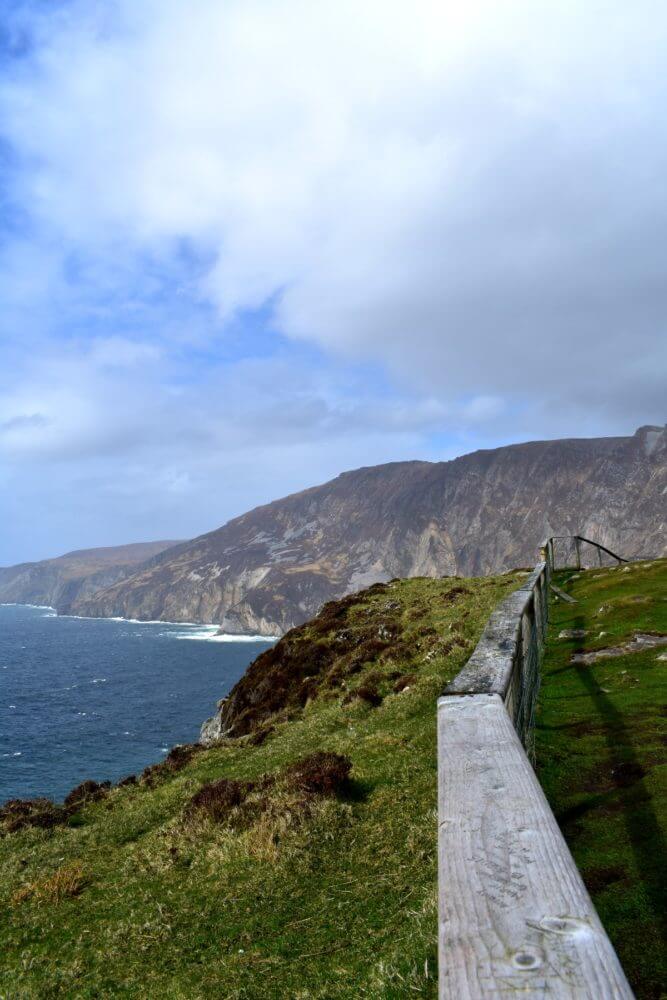
You will begin at the base where you’ll find a large gate at the small car park. Help yourself through the gate and make your way up the hill. The road is paved and an easy drive up. Don’t be afraid to stop and take pictures along the way up to the base. To your left you’ll see some stunning views already of the coast line and a peek at one of the watch towers!
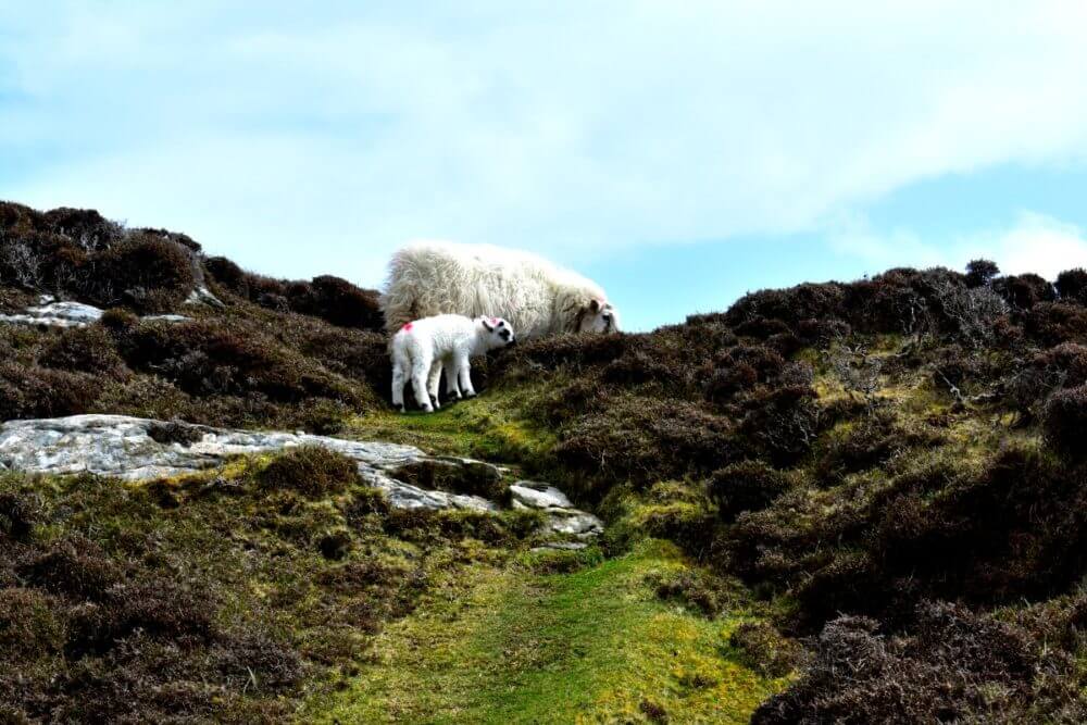
Traveler’s Note: The gate will be closed to keep the sheep from exiting. Per the not-so-easy-to-see sign, get out of the car and help yourself to opening the gate to drive through and up the road; otherwise you’ll adding another mile to your trek! And don’t forget to close the gate behind you!
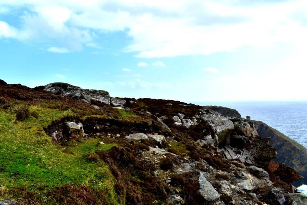
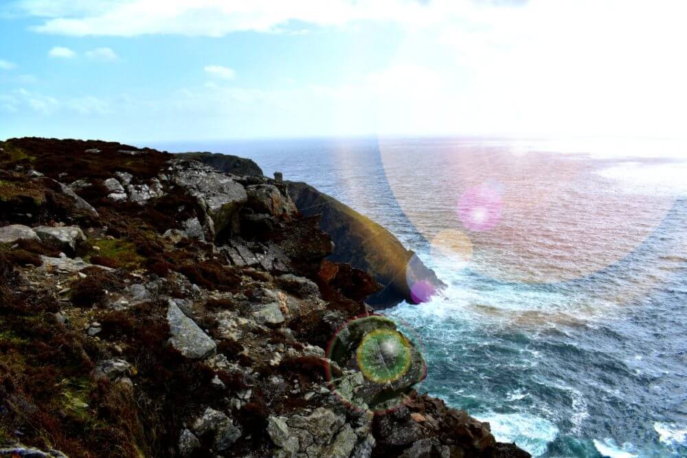
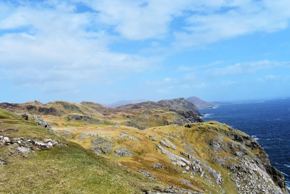
As you make your way up the road to the main car park you’ll have some spectacular vista points already to take advantage of. This viewpoint is of the easternside of the League, located on the south side. There is a trail that you can walk the entirety of the cliffs, so if you want to make sure to arrive earlier and bring good shoes!
Traveler’s Note: There’s no admission or parking fee.
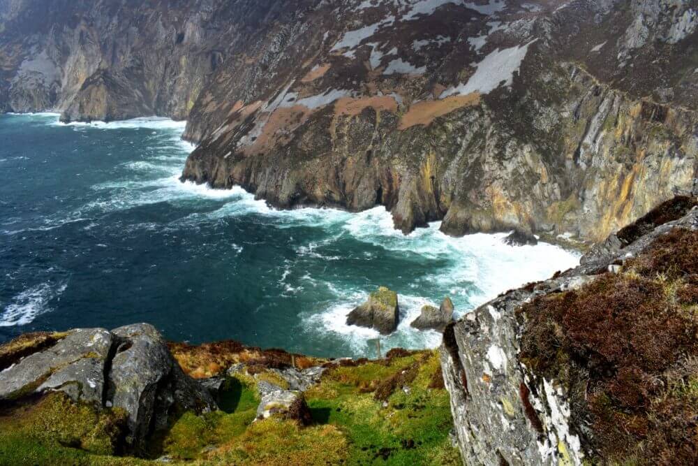
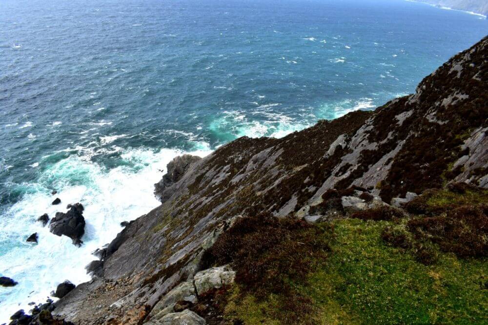
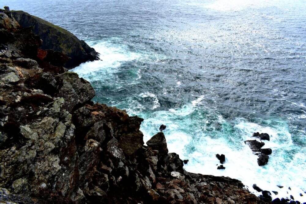
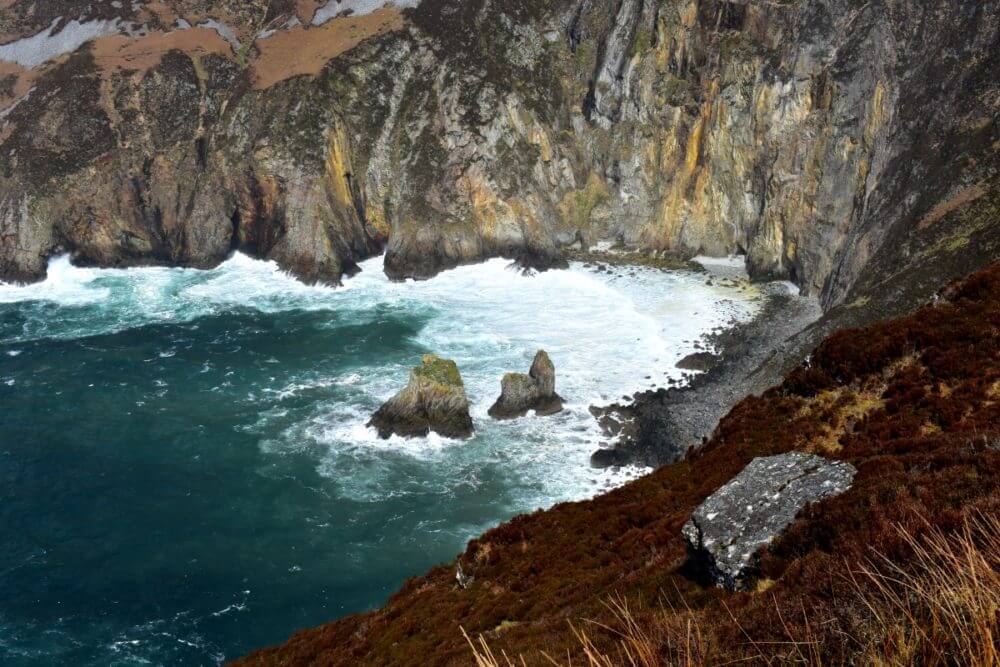
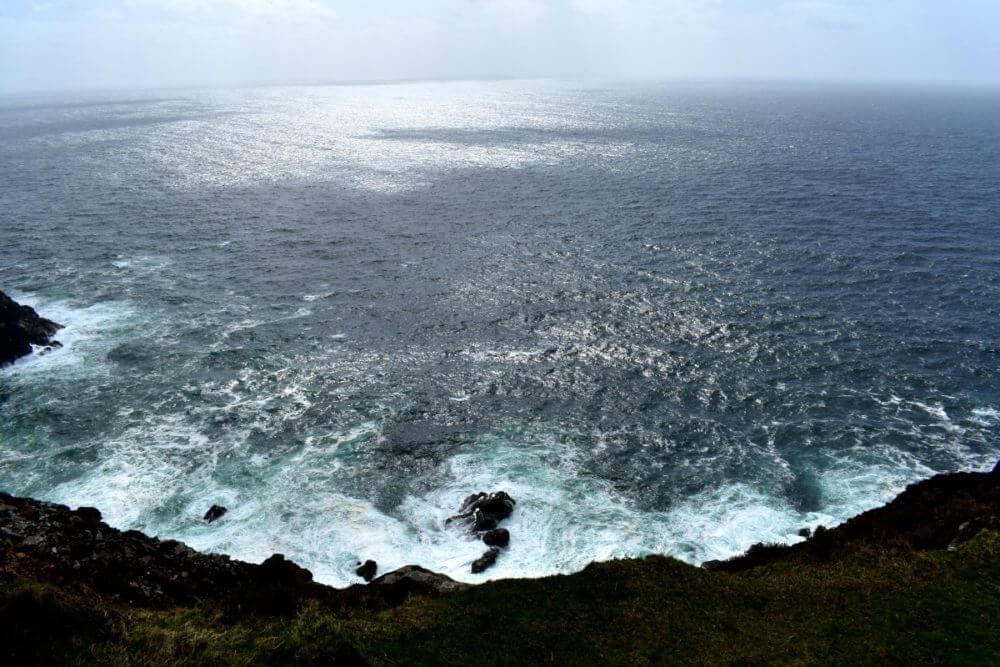
It’s really spectacular to spend a bit of time here and see how the topography changes colors before your eyes as the sun and clouds move in and out of the space. The water changes from a deep sapphire blue to a bright Caribbean turquoise. The field glows in the sun, bright greens and brilliant sun yellow and rusty coppers around the grey stones.
What’s really interesting though is to see the cliffs themselves — the reddish coppery tone seems to indicate iron deposits in the rock. You can see how the iron has seeped into the soil surrounding as well, giving way to that coppery auburn tone to some of the vegetation.
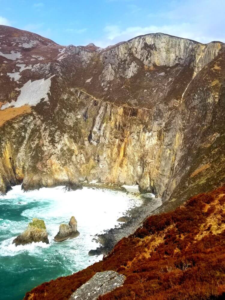
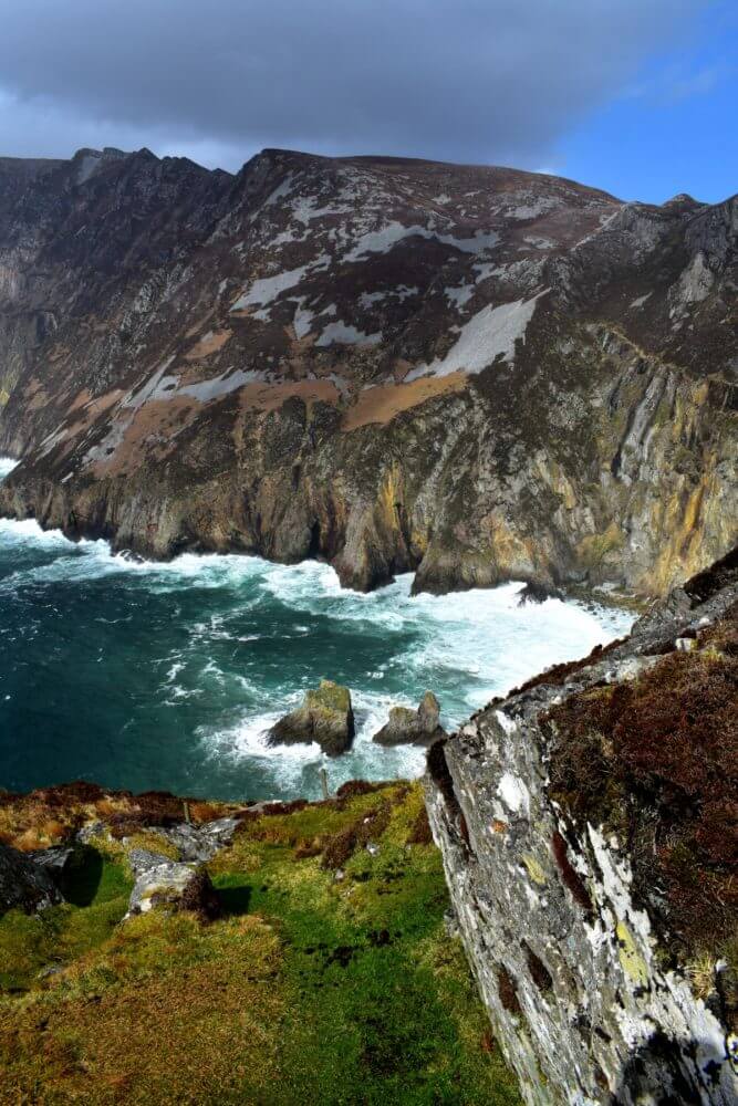
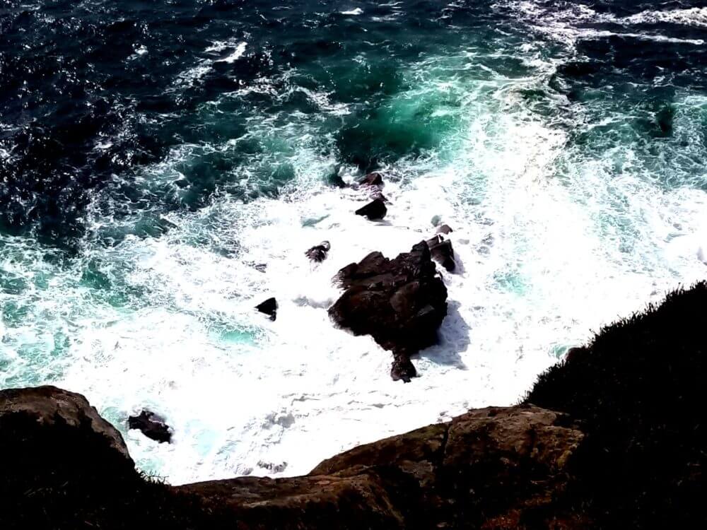
These two “little” rocks in the bay are knows as the “Giant’s Table and Chair.” It’s a must-photograph icon when you visit!
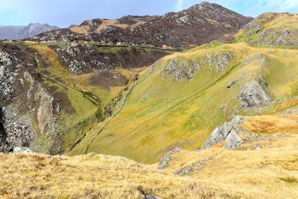
But for those who can take a bit more of a trek, consider taking the Pilgrim’s Path. This is a 4 km trail built on an ancient path through the valley between Leargadachtan Mountain and Shanbally. The route is difficult and for the experienced, healthy trail walker but worth the effort: you’ll be rewarded with incredible views of the valley, the harbor, and even a waterfall! This path will take you an additional 500m above sea level so again, it’s important to know your fitness level or consider going with an experienced guide.
Also please note: DO NOT ATTEMPT THIS CLIMB IF THERE IS FOG OR LOW CLOUDS. There is some serious heights on this path and at one point it gets quite narrow — signs posting around caution against attempting in conditions where it can impede your ability to see in front and side of you! Not recommended for small children.
Traveler’s Note: Plan ahead if you want to do the trail. Bring proper shoes, water, snacks, clothing to get you through. We arrived and wanted to do it but were unprepared so had to save it for next time!
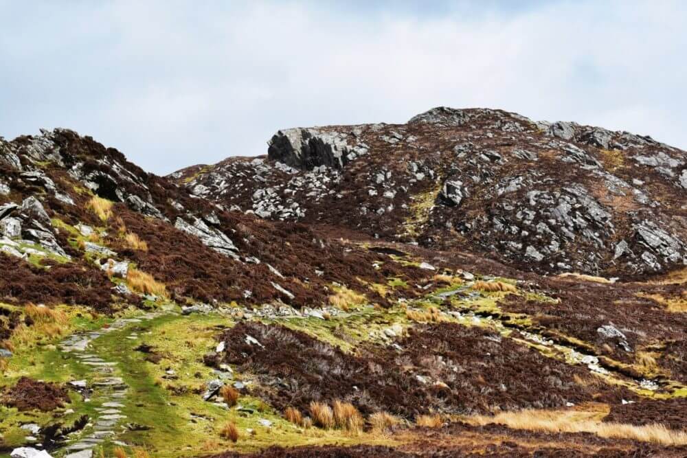
The trail as you begin to ascend into the cliffs. The trail for the most part is carved out with stones but you’ll have patches of grass and mud that can be quite slipper from the rain and slope!
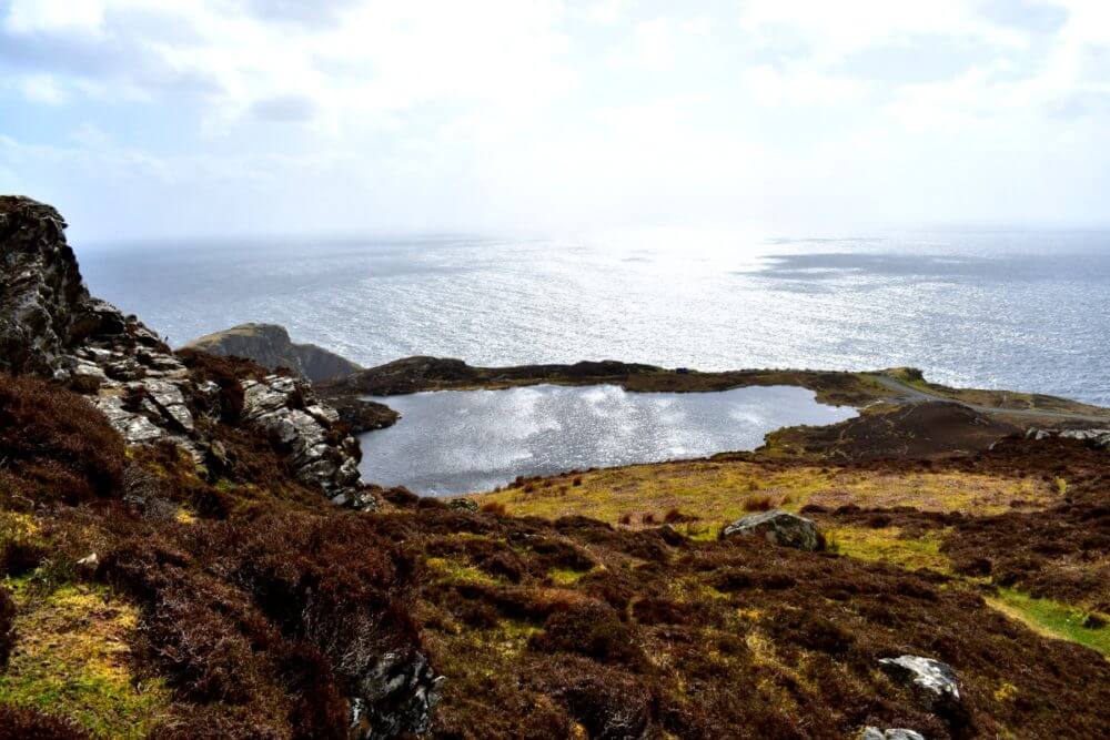
There are two small lakes on the Slieve trail. This is Lough O’Mulligan. It’s a picturesque stop overlooking the ocean. We stopped for a rest and a quick snack of Taytos and water in the alcove of a small rock cave!
A Peek Into The Past
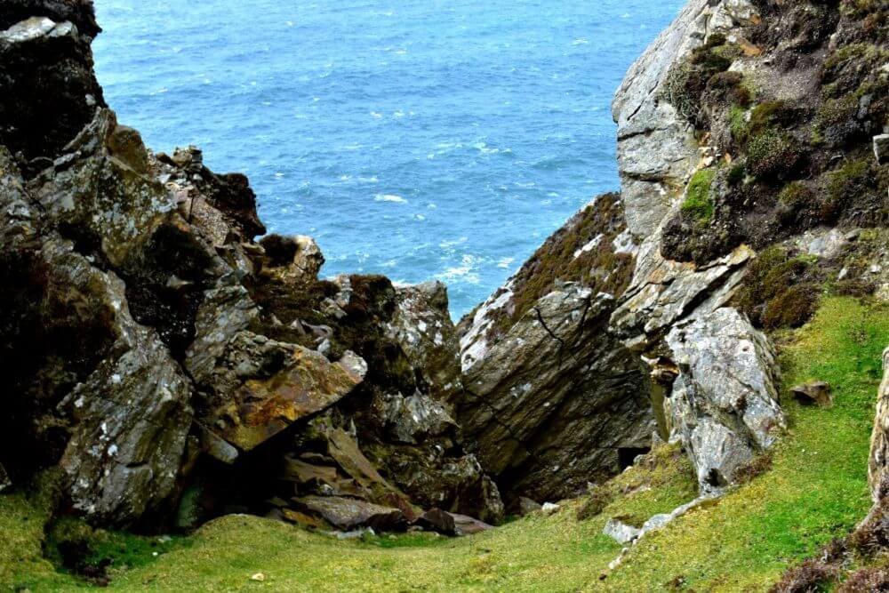
This place of stunning beauty and serenity was once a home thousands of years ago. Hidden among the mountains off the perilous trail you can find a small crop of ancient stones marked by the ancient pre-Christian Celts. Sliagh Liag was well known throughout Ireland as a sacred mountain long before Christianity arrived. With its incredible connection to nature and the feeling you are that much closer to the heavens, it is no wonder early Christian settlers chose this for a small, monastic village some years later.
Not much is known about the early Christian settlers. We do know that in the 5th century there was a small monastery built on Rathlin O’Birne island, a small island off the coast as you look out from the cliffs. It is said that St. Asicus (coppersmith to St. Patrick and eventual bishop of Elphin) came here and lived on the island as a hermit for seven years. Today the island has a solar powered lighthouse you can visit.
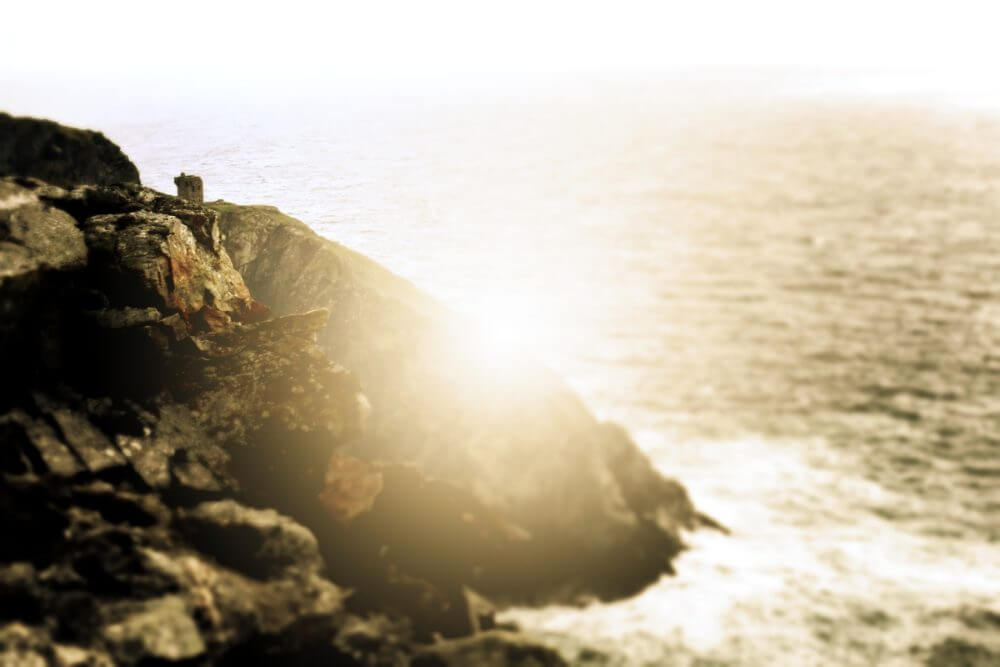
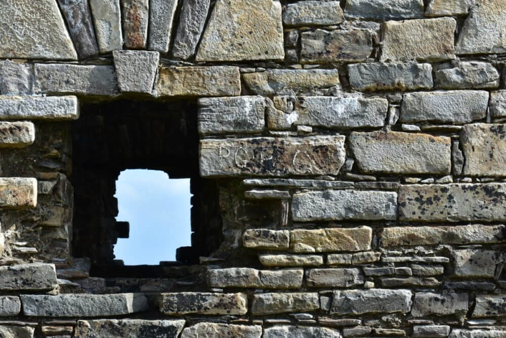
Meanwhile on the cliffside you can find the remnants of another early Christian settlement. A little off the beaten path, but follow the tower and you’ll be blown away by the scenery and serenity of the space.
The path to take is not obviously marked and it’s really easy to get off the path. Use the ocean and the watch tower to orientate yourself so you don’t get lost!
You can see the stone wall markings built into the mountainside. These were used to help keep livestock safely in as well as marking the boundaries of the village.
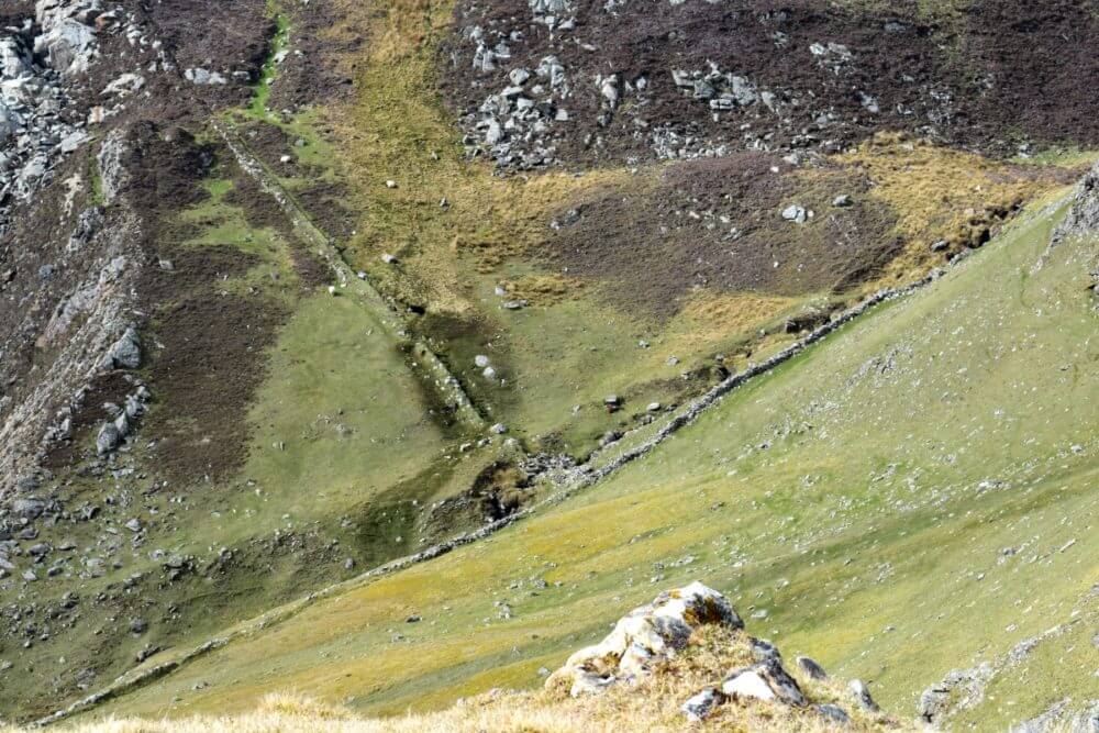
You can take a path to visit the ruins of this village — indentations in the earth, flattened golden grass and stones that once served as foundations are all that’s left today. It’s absolutely fascinating to explore: you can walk out the size of each hut and house, you can see the cooking pit stones still aligned outside of the house, you can see the stone walls that marked off the land, keeping the sheep and livestock in.
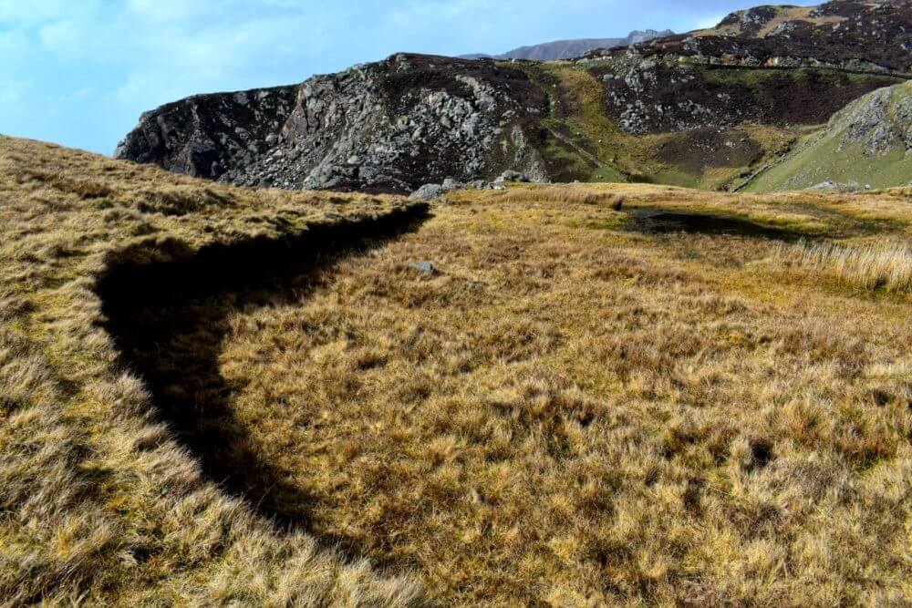
The indentation into the earth like this picture indicates where a house or hut once stood. Walk around the space and look at the different shapes you can find (square, rounded, rectangular) to give you a sense of the sizes and styles of buildings here. Stand outside where the doorway once stood and look out around you — you’re see the same view and hearing the same sounds these peaceful people did a thousand years ago!
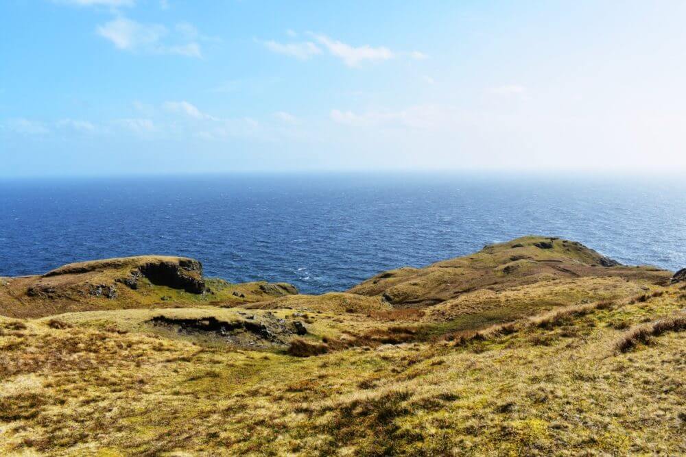
Winding up from the base of the cliffs and soaring ever higher, you will not be disappointed with the incredible views and photo opportunities. Wear sturdy shoes and depending on the time of year, be prepared for mud and soaked feet. The path is often simply rocks and grass so it can get a bit slippery and slick.
Pay attention to the small signs off the road and get a map to explore out towards the head of the cliffs. You’ll find yourself completely immersed with nature, up front and close with a sheep or two (or five), and stumble upon those early Christian villages that are literally preserved in time. Take a moment to listen — the wind whipping about you will guide your heart to what the village looked like, sounded like, smelled like…you’ll hear the faintest sounds of a small bustling village around you.
The Watchtowers
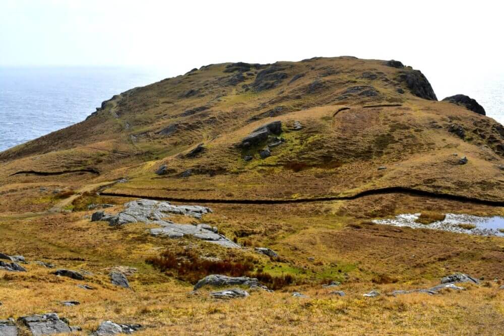
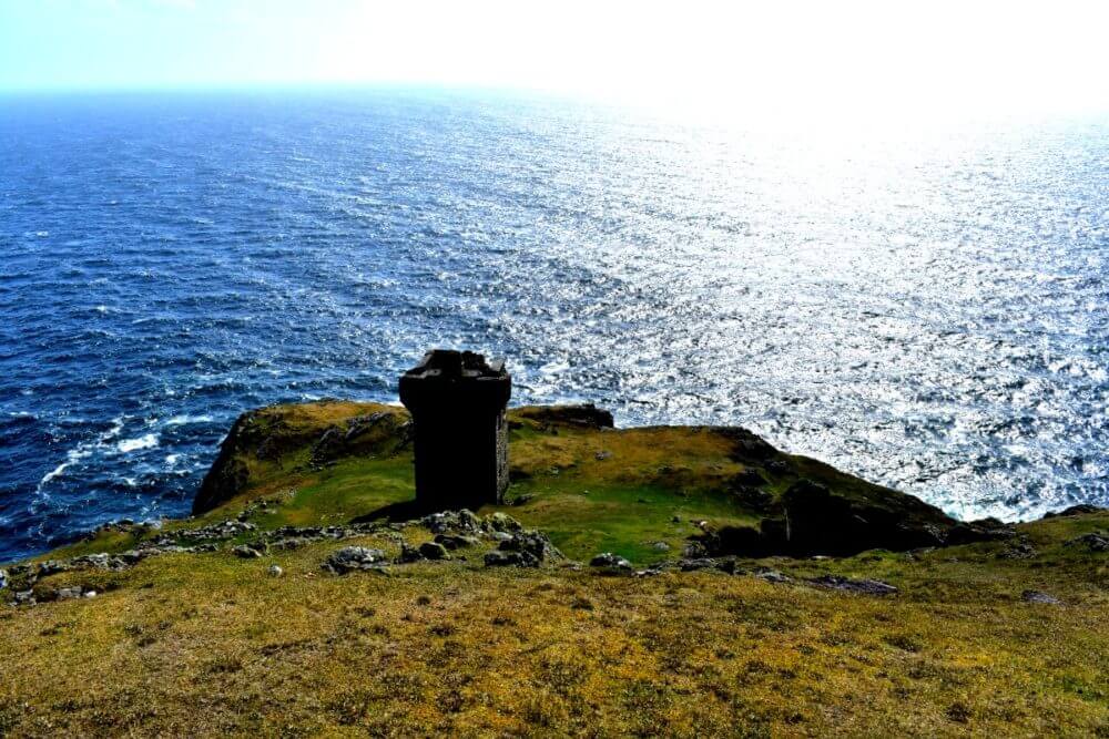
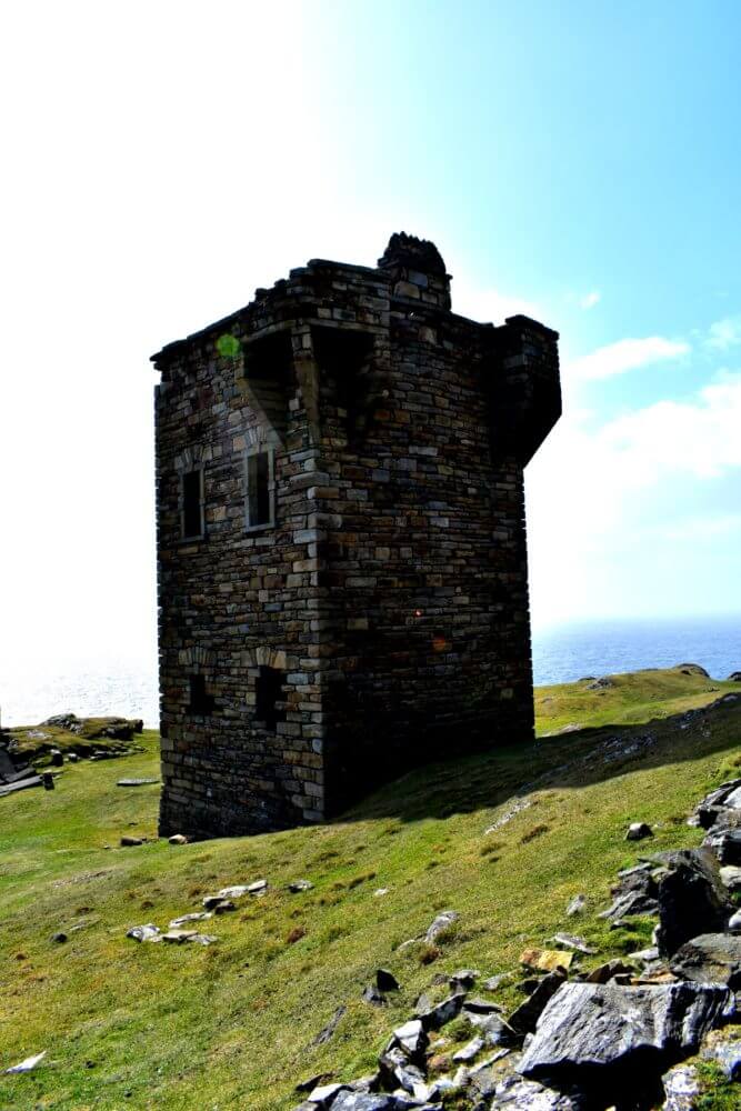
One of the more standout ruins at Slieve League is the watchtowers. These brown and grey stone towers you’ll find dotted around the coastline every few miles or so and were built in the early 1800’s as an early warning system against the French during the Napoleonic wars. The watcher would stay in the tower and should he see French ships off the coast, would light a beacon which would then signal the other towers along the coast and inland, providing (hopefully) enough lead time to evacuate everyone to safety and alert the army. Although Napolean never made it to Ireland, one could never be too safe.
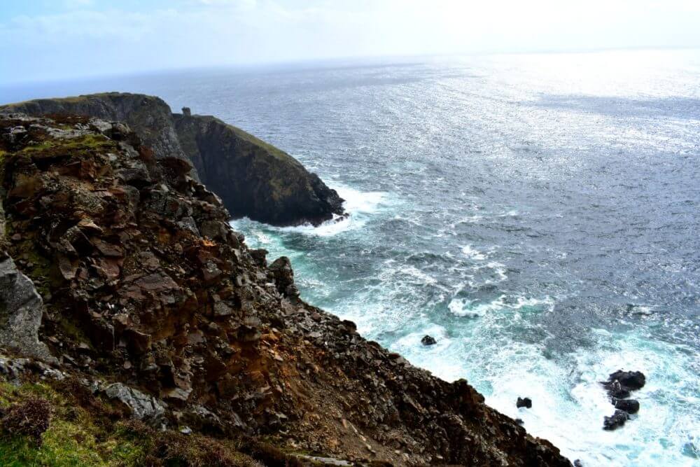
At Carrigan Head, one of the outlets of the cliffs, you can see a signal tower built in 1805. The tower is visible from the road you take to get up to the main car park, but you can also hop off and take the trail to the tower itself. We made it there and it was a spectacular view and really incredible to see up close. As you make your way through the countryside and monastic village ruins, you’ll get closer and closer to this incredible tower.
Traveler’s Note: Be careful! The wind here is insane and no joke, can blow you down and over the cliff’s side! Hold on to those cameras and have a sure footing as you make your way around!
An Epic Destination Wedding
Inspired by this incredible natural backdrop? Looking to incorporate more sight-seeing suggestions like this on your trip? Contact us today to start talking about hosting your dream destination wedding in Ireland. We love the northwest and the Wild Atlantic Way has given us some of the most spectacular elopements and weddings to date, and we want more! From Kinsale to Donegal, we are excited to incorporate more of the breathtaking locations Ireland has to offer and have already scouted out some pretty incredible spaces and locations to serve as backdrop for your wedding day. On top of that, a team of vendors perfectly suited to bring your vision to life and photographers ready to perfectly capture the day.
Contact us today and make sure to check out more in our slideshow below!
All photos copyright Michelle Escobar.
[pp_gallery id=”27410″]


comments +